Stationed For a Day at Stanford’s Hopkins Marine

California, Inquiries, Travel

Quick Note: In some cases, pictures might appear much smaller than intended. Clicking on the picture should let you see it clearly. For mobile devices, some images might appear cutoff. A temporary workaround is to read the article in a landscape orientation. Thanks for your understanding as I solve these issues!

            Of all things, Star Trek, was the first time I saw the Monterey Bay. It’s quite the story, where a criminally indicted Admiral Kirk and his crew must save 23rd century Earth’s oceans from a cataclysmic event. How? Undoing the tragic extinction of whales by time traveling to the 1980s, bulgarizing a newly opened Monterey Bay Aquarium, and defeating villainous whalers (Giggster)! Leonard Nimoy, playing Spock, after reading a book, created and directed the story to inspire people to protect vulnerable wildlife (“30 Facts”). And I have to say, it’s fitting that the place I visited be directly adjacent to the aquarium that movie was filmed: The Hopkins Marine Station in Pacific Grove (2020 pop. 15,090), part of Stanford University’s Doerr School of Sustainability (“Race”).
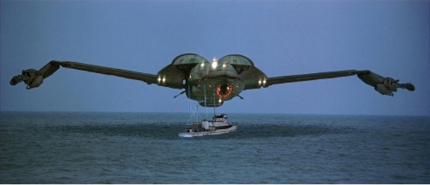
Stopping whaling by any means necessary. Source: Memory Alpha

            I didn’t realize that proximity until I arrived, and all I knew beforehand was that there was a library on marine biology, it was on the coast, and research is performed there. Besides the 17-mile-drive, I had little to go on as to how the bay would even look like. And bizarrely, I don’t think many of Stanford’s community know of the satellite campus’s existence… I tried asking two computer science majors from the Bay Area, and they were utterly bemused by its existence! That’s to say, I was excited to see an oft-discussed part of Stanford!

The First Building

            My first impression was the warmer than expected mid-50s temperature (Accuweather). The campus itself seemed quite empty, likely due to it being Saturday. Many of the arrivals were recovering from dizziness since we unexpectedly took the twisty CA-17 rather than the more commercial US-101. We parked behind some buildings and were guided into the Harold A. Miller Library as the Teaching Assistants (TAs)[1] Mikaela and Sidney made final preparations. As the library for marine biology, it indeed covers highly specialized catalogue topics like Marine Studies of San Pedro Bay, California, Aquarium Buildings: Construction and Design Manual, and I AM NOT AN OCTOPUS.

Harold A. Miller Library Collection

           But this is the first time I’ve seen such a cluttered repository! Some objects seemed deliberately disorganized, as if cleaning up would ruin someone’s day. This includes a John Steinbeck book collection, a face caricature, fake harbor seal (Phoca vitulina) skulls, Stanford-branded typewriter, and of course a blue whale plushie. I really like it because while messy, it radiates that homey, lived in vibe immaculate libraries tend to lack. Yet what drew me in most was this awing, eye-dropping first view of the coast! That’s when the TAs introduced our guides Abby McConnell of Student Services and Professor Robin Elahi, and thus began our tour starting with its history.

Through the Library Glass

            The Hopkins Marine Station was built on the Ohlone Rumsen homeland, living there until the Spanish displaced them. This region in the 19th century would become a predominately Chinese community with abalone and squid fishing driving the economy of China Point and its surroundings. In 1892, Stanford University opened the Hopkins Seaside Laboratory at nearby Lover’s Point, becoming the first marine research facility in the U.S. West Coast (“History”). The Chinese community were displaced by a fire in 1906, suspected by some to have been premediated due to Sinophobia (Li). The laboratory in Lover’s Point was relocated to China Point in 1917 and was given its current name of Hopkins Marine Station. Then the coastline and surrounding waters were designated in 1931 as the Hopkins Marine Life Refuge. Today, the refuge has grown and evolved into the Lovers Point – Julia Platt State Marine Reserve, anchored in Lover’s Point, Monterey Bay Aquarium, and Point Cabrillo (the former China Point), making it “unlawful to injure, damage, take, or possess any living, geological, or cultural marine resource” (“History;” SMR). I asked Professor Elahi if the history of sardine overfishing in the Monterey Bay led to Trophic Drama (food chain shenanigans) in the ecosystem. He said that sardine landings dropped drastically in the mid-20th century, haven’t recovered, and that fisheries shifted to squid, salmon, and other fish valuable to fine dining restaurants.   
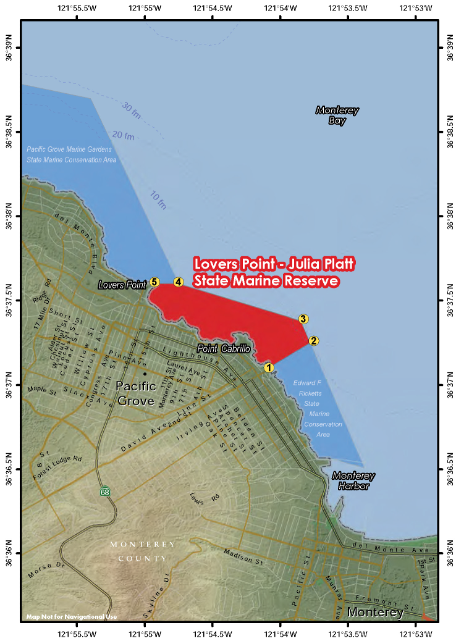
A map of the state marine reserve. The Hopkins Marine Station is at Point Cabrillo, the Monterey Bay Aquarium is where the 1 is marked, and Lovers Point is the station was originally located. Source: SMR.

            Then, the TAs and tour guides divided us into two groups. We were to do the same activities in a different order, and I was assigned to McConnell’s group. She took us to the oldest building built in 1918 to see one of the classrooms (“First Building”). It had a chalkboard, rather than a whiteboard, and had a bunch of optical gear in the back from microscopes to binoculars. The most unique feature though must be the clear view of the coast! On fogless days, I can imagine such a sight be really motivating or calming to see during class or study. It is a small classroom though, so we were filing in and out to give each other the space to see the room. As it was starting to empty, I took the opportunity to see the back of the classroom and perhaps peek into the glass cabinets. Though the building started becoming quieter as I peeked inside… then I realized my mistake…

I got lost without even trying. Sigh. (Drat! THE TA’S OUGHT TO BE FURIOUS! EEK!)

Classroom

            I cluelessly went up and down the different floors to see if I could discern my group’s direction. Confusion gave way to dread, with no way to contact the TAs, and the coastal view keeping me company. There I saw the other group exiting the library, and thus sprinted out to join them. The other TA was surprised, but she contacted her peer of my unanticipated switcheroo. All’s well that that ends well, I guess… but I’ll prudently avoid falling behind. We went to a trail in Point Cabrillo.

Point Cabrillo

            There we talked about different topics, from the local flora and fauna, to how courses taught at the station use the surrounding nature to engage with the material. I asked about that sprawling green-red grass-ish plant because I had no idea what it was. And think the red-ish colored gradient and thick leaves evoke an alien otherworldly vibe. I wondered if it was endemic to California since the Sonoma County coast was where I first saw it. Professor Elahi explained that Iceplant (Carpobrotus edulis) is an invasive species introduced as an anti-erosion stabilization measure for land surrounding roads. Per the California Department of Fish and Wildlife, Iceplant is native to coastal ecosystems in South Africa, and it spread as north as Humboldt County (where Eureka is) and as south as Baja California, Mexico (“Invasive to Avoid: Iceplant”). The truth was thus contrary to what I thought! But then does the area have any endemic species? Elahi said he couldn’t think of any, and that he associates the concept of endemism to islands, rather than California’s large ecosystem that includes Southern Oregon. Hmm… the seemingly odd line of questioning might stem from being raised in a Caribbean Island, where endemic species are acknowledged and promoted as part of the local cultural identity. Perhaps that way of thinking doesn’t translate to the larger continents. It was an opportunity for him to introduce the unique underwater Monterey Canyon that transports nutrients to the bay and makes it a good area for wildlife.

Professor Robin Elahi's Tour

           Another interesting feature of note shown by Professor Elahi are these old, rusted train tracks. They were built when the fishing industry was prominent in the local economy. The tracks were used to transport boats in and out of the water to be repaired at the Monterey Boat Works building. Now both are relics of a bygone era.

Monterey Boat Works Rails

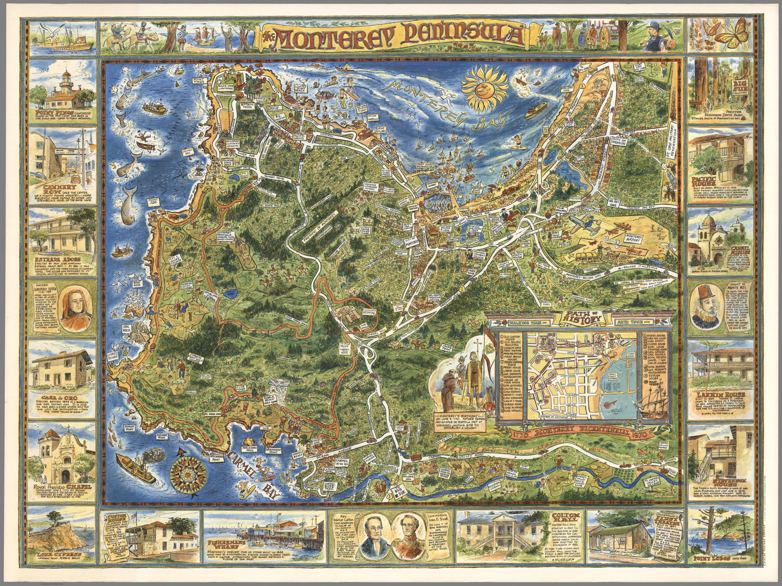
            I mention this specifically because an artist in 1970 oddly thought these rails were relevant enough to be included in a pictographic map of the Monterey Bay. The locally produced map was created to celebrate Monterey’s Bicentennial and presented the most important features, attractions, and activities (Bibler). While I couldn’t find much information online about the rails (besides a Stanford written article of the Boat Works), both Professor Elahi and artist Richard Bibler thought it important to note as a defining feature of the area, despite a 53 year gap between this tour and map. Who would have thought these abandoned rails could be so societally important!

Click on the map and zoom in towards Hopkins Marine Station! Source: Bibler

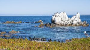
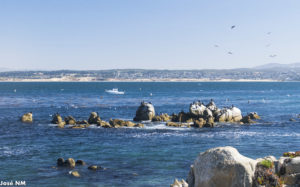
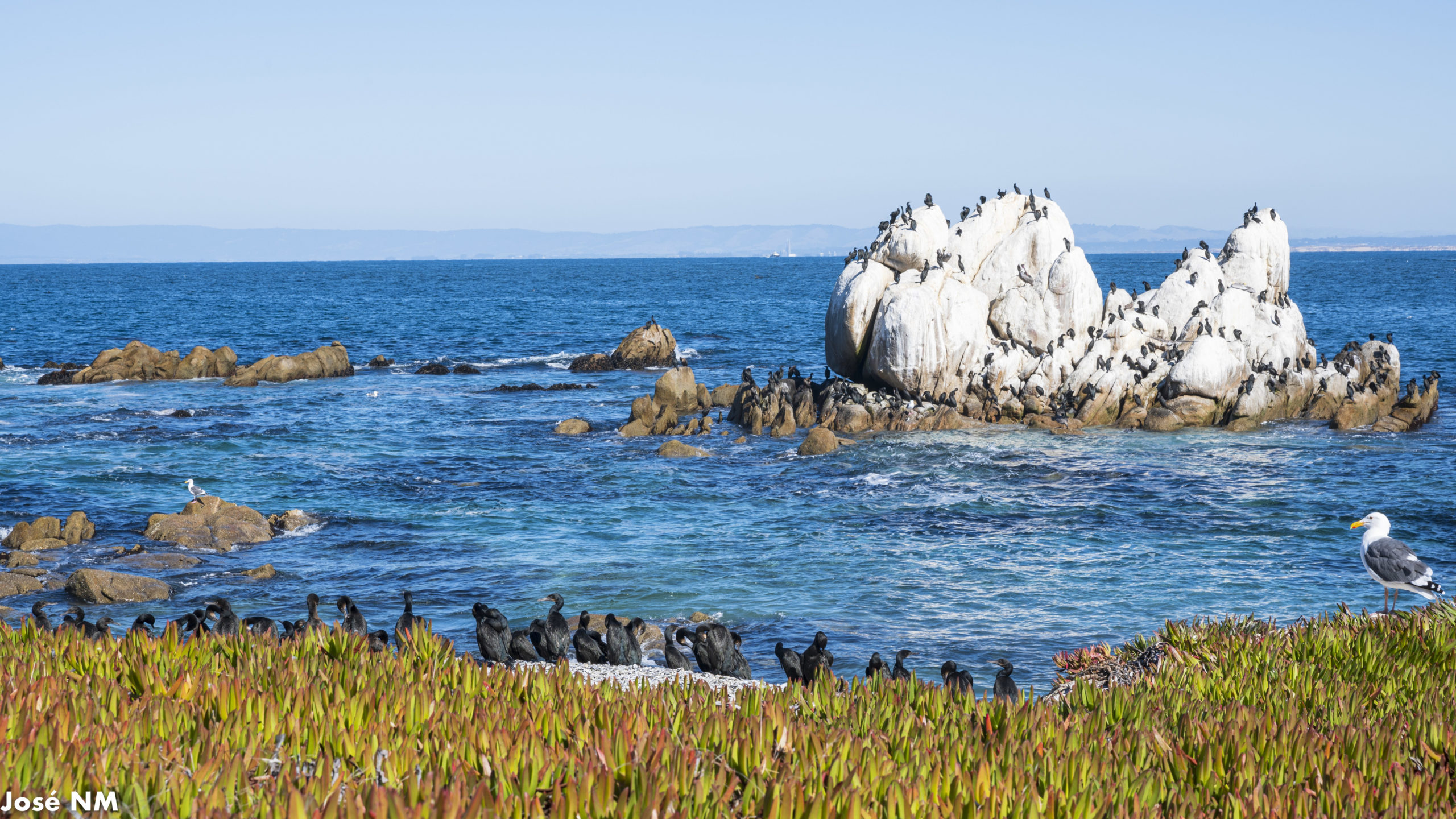
           With that, it was time for an exercise demonstrating the kinds of activities students undertake at the station. We were given binoculars, marine life guides, and QR codes to enumerate seal, cormorant (Urile penicillatus I uh think?[2]), gull (Larus occidentalis), Brown Pelican (Pelecanus occidentalis), and Black Oystercatcher (Haematopus bachmani) populations at Seal and Bird Rocks (Pacific Grove Museum of Natural History; Monterey Bay Aquarium; All About Birds). We’d count the number of a species in each rock and submit our results via a QR Code accessible Google Form, except for the Black Oystercatcher where they only asked if we heard or saw at least one.  

Activity Items

            The biggest challenge with this is handling many objects at the same time, while maintaining focus and not lose count… especially since individuals are in a small densely populated area. Anyways, here goes nothing!

           For seals, there were two individuals in their namesake rock and none at Bird Rock! My peers and me were excited to point them out!

Seals at Seal Rocks

            For cormorants, the black birds with the blue eyes, there were 46 at Seal Rocks and 104(!!!) at Bird Rock! These were by far the hardest to count and not lose track of.

Cormorant (Urile penicillatus I Think)

           For gulls, there was 1 at Seals Rock and 4 at Bird Rock!

A Gull (Larus occidentalis)

           For brown pelicans, I didn’t see any at Seals Rock, but I did see 1 at Birds Rock! I think these were more abundant at the shoreline, but that’s outside the countable area.

Brown Pelicans (Pelecanus occidentalis)

           I didn’t hear or see a Black Oystercatcher.

           I think it was an interesting, spontaneous experience. The biggest impediment was sampling individuals that were moving inside the sampled area, since individuals from the same species look so similar, and it’s difficult to tell when you’ve already sampled a given individual unless you precisely pan your field of view. Also, many birds are entering, exiting, or simply flying through the area of interest, and this will inevitably lead to some variation between the samples taken between me and my peers. Lastly, some species of birds such as gulls and pelicans were present, but their count is low simply since they were located outside the area of interest, making them appear rarer than actuality. Since all our samples were recorded, I wonder when we’ll find out how they were used. And how much did my counts vary from the average?

Moving Sample

            After this activity, it was lunch time! People who finished early or came from the group I got separated from were already eating from a Pizza My Heart order. I went to the room with the pizza… and it was long gone… Oops! If you want to eat, make sure you finish early and get a slice, or you’ll end up with nothing. Ah well, I used it as an opportunity to wander and take pictures!

Dauphin

            We were then guided into the Monterey Boat Works building, now converted into the Isabella “Izzie” Abbott Lecture Hall to watch Abby McConnell’s presentation regarding undergraduate opportunities at the station. Do pay attention to the slides; I erred by asking a question that was answered on the current slide, clumsily sounding like I was looking for excuses.

Monterey Boat Works

           Programs in the 2023-2024 year were handled differently between the winter and spring quarters. For the winter quarter, they offered three[3] in-person courses held on Friday. Professor Elahi is himself teaching OCEANS 161H/261H — Between Pacific Tides: Invertebrate Zoology in Monterey Bay, a course that has the good omen of being popular within the TA team. Students reach the station with their own car, carpool, or with sufficient enrollment a private shuttle (McConnell seemed skeptical of this happening). For spring quarter, they have a ‘study abroad’ program where you stay in a shared house with students and stay near the campus. Weirdly though, since the trip[4] they seemed to have waived the residential requirement for this academic year.

Abby McConnell's Presentation

           Up-to-date information can be found at hopkinsmarinestation.stanford.edu/. The astute can also use ExploreCourses by searching for courses with the code “OCEANS” and have the letter “H” in the class-number. Most of the courses are tied to the marine sciences or biology. My instinct is that it might be difficult, but not implausible, for underclassmen and humanities majors to register. Students in those categories should consider emailing the professor of that course.

Isabella “Izzie” Abbott Lecture Hall

           If you are a traveler, tourist, or student who just wants to visit the Hopkins Marine Station, the easiest way in is likely by paying into the ‘Friends of Hopkins’ program that includes the in-person ‘Friends of HMS Lecture Series[5]’ and ‘Annual Picnic and Open House.’ It costs $100 USD for the public and $25 for academia. This isn’t a tourist attraction, but that doesn’t preclude visiting, and it’s a certainly interesting place!

Friends of Hopkins Marine Sign

            If there’s anything I took away from my trip to Hopkins Marine Station, is that even in an empty Saturday, you can feel the radiant energy of comings and goings of this place. For someone interested in biology or marine ecology, this is a perfect place to relish what you’ve learned. For the social sciences, it’s a unique place to see how humans engage with the environment. And for the arts, one can conjure up depictions of animals, create new worlds and environments, or imagine what adventures might happen there… sans the burglarized aquarium. And even with my mistakes, I really enjoyed my time. Seriously, if I failed to show you the awesomeness of Hopkins Marine Station, then I at least hope I convinced you to watch Star Trek IV: The Voyage Home.

Whale Plushie!

           Lastly, I want to give my gratitude to Abby McConnell and Professor Robin Elahi, for giving up their Saturday to give us a tour, to TAs Mikaela and Sidney for stomaching my antics, and to Ellie for suggesting I visit this place.

            I took many other pictures in this trip. Check them out in this gallery:


Interested in reading more of my posts? Subscribe using the form below!

Loading

Footnotes

[1] They are teaching assistants for the course EARTHSYS 10: Introduction to Earth Systems. They are mostly coterminal students in the same department.

[2] Phylogeny is not in my comfort zone… if you could confirm or clarify in the comments, I’d be grateful!

[3] The other two courses are OCEANS 74H/BIO 74: Sustainability in Marine Organisms: Learning from the Evolutionary Survivors and OCEANS 157H/257H/ENGLISH 91AI: Creative Writing & Science: The Artful Interpreter.

[4] Click the before and after links to see how the residential requirement changed.

[5] You might want to investigate this, because there is an apparent contradiction in the site that says that lectures are still virtual on the main site, but the newest events claim to have an in-person component at the Monterey Boat Works.

References

“Alexander Agassiz Laboratory.” Campus Engagement, Stanford University Office of External Relations, campusengagement.stanford.edu/projects/annotative-signs/alexander-agassiz-laboratory. Accessed Dec. 2023. [Archived Site]

“Black Oystercatchers.” Pacific Grove Museum of Natural History, www.pgmuseum.org/blackoystercatcher. Accessed Dec. 2023. [Archived Site]

 Bibler, Richard. “Monterey Peninsula. Bibler Feature Service.” David Rumsey Historical Map Collection, Cartography Associates, www.davidrumsey.com/luna/servlet/s/tc80d0. Accessed Dec. 2023. [Archived Site]

“Brandt’s Cormorant.” All About Birds, Cornell University Lab of Ornithology, www.allaboutbirds.org/guide/Brandts_Cormorant/overview. Accessed Dec. 2023. [Archived Site]

“Lovers Point – Julia Platt State Marine Reserve.” California Department of Fish and Wildlife, www.nrm.dfg.ca.gov/FileHandler.ashx?DocumentID=96729&inline. Accessed Dec. 2023. [Archived Site]

“Harbor Seals.” Pacific Grove Museum of Natural History, www.pgmuseum.org/harborseals. Accessed Dec. 2023. [Archived Site]

“History.” Hopkins Marine Station History, Stanford Univieristy Doerr School of Sustainability, hopkinsmarinestation.stanford.edu/about/history. Accessed Dec. 2023. [Archived Site]

“Invasive to Avoid: Iceplant.” California Department of Fish and Wildlife, wildlife.ca.gov/Conservation/Plants/Dont-Plant-Me/Iceplant#22064102-california-native-plant-information. Accessed Dec. 2023. [Archived Site]

Klingon Ship Over Whaling Ship. Fandom (Memory Alpha), Fandom, https://memory-alpha.fandom.com/wiki/File:HMS_Bounty.jpg.

Screenshot of scene in Star Trek IV: The Voyage Home [Archived Site]

Li, Han. “A Chinese Fishing Village Burned Down in Monterey in 1906. Now, It’s Being Remembered.” The San Francisco Standard, 28 May 2023, sfstandard.com/2023/05/28/monterey-bay-remembers-the-chinese-fishing-village-that-burned-a-century-ago/. [Archived Site]

Maria  Jose, and John Tenuto. “The Voyage Home: 30 Facts for 30 Years.” Star Trek, CBS Studios Inc, 9 Aug. 2023, www.startrek.com/news/the-voyage-home-30-facts-for-30-years. [Archived Site]

“Pacific Grove, CA October 2023 Monthly Weather.” AccuWeather, www.accuweather.com/en/us/pacific-grove/93950/october-weather/2154426. Accessed Dec. 2023. [Archived Site]

U.S. Census Bureau. “RACE.” Decennial Census, DEC Redistricting Data (PL 94-171), Table P1, 2020, https://data.census.gov/table/DECENNIALPL2020.P1?g=160XX00US0654848. Accessed on December 8, 2023. [Archived Site]

“Western Gull.” Monterey Bay Aquarium, www.montereybayaquarium.org/animals/animals-a-to-z/western-gull. Accessed Dec. 2023. [Archived Site]

“Where Was Star Trek IV: The Voyage Home Filmed?” Giggster, Giggster, www.giggster.com/guide/movie-location/where-was-star-trek-iv-the-voyage-home-filmed. Accessed Dec. 2023. [Archived Site]
Astro’s Playroom Review: More Than Nostalgia? [Test Article #3]

Japanese, Platformer, PlayStation 5, Reviews, Strongly Recommend, Video Games

Astro’s Playroom is a game celebrating the world and heritage of PlayStation by giving you the opportunity to explore a literal “world” inside the futuristic looking PlayStation 5 (PS5). Being a showpiece of both past and future, it is currently a free tie-in pre-installed every new PS5. But, um… I only really know one PlayStation related franchise: the racing series Gran Turismo. Is this celebration fun or worthwhile to someone with little or no nostalgia or attachment to its legacy? Is this game a competent 3D platform without preaching to the choir? Yes, because it familiarizes you with the new controller and still has an interesting world to explore, albeit sometimes wishing that the game volunteered just a little more context. 

NameAstro’s Playroom
GenreAction, Platformer
PlatformPlayStation 5 (Exclusive)
ESRBEveryone 10+
Release Year2020
DeveloperTeam Asobi
PublisherSony Interactive Entertainment
CountryJapan
WebsiteOfficial Site
Game Information

First and foremost, and the game makes it very clear itself, Astro’s Playroom is designed to weave players into the DualSense controller, and familiarizing players with all its features in a coherent package. In that sense, this game is really helpful for people whom have never played non-mobile video games or have not done so in the last twenty years. People familiar with Team Asobi1, might recognize them as the developers of Astro Bot: Rescue Mission, a showpiece for PlayStation VR. Their main value appears to be demonstrating why PlayStation is innovative, rather than iterative.

The game is comprised of four worlds (with four tightly integrated levels) that can be played in any order to unlock a final stage, for a total of seventeen courses. Each level is themed around a piece of hardware inside a PS5 and one of the four prior iterations, with the end goal being to collect all five first model PlayStations. 

The courses themselves are not too long nor difficult if one simply wants to beat them expediently, as the main challenge and side goal is to try to explore your surroundings, take more challenging side-paths, or generally go off the the beaten path to discover puzzle pieces and additional “artifacts” (i.e. console variations, accessories, etc.). There is no penalty or lives lost if you make a mistake, probably as it would feel demotivating making mistakes while trying to learn the basics of utilizing the controller’s features. The motivation to keep playing and challenging yourself stems from the artifacts and collecting enough coins to outright buy the remaining collectables at Labo.

Labo is the gallery where you see the mural being built and can interact with the artifacts you collected or bought. You buy access to additional puzzle pieces, artifacts, or new residents that interact in Labo (making it feel more alive as you progress through the game. Although you have to spend your coins on a gacha machine, there are not many useless duds that make you feel that the game is unfairly rigged against you. The gacha machine at worst seems to only remove the player’s ability to choose the order in that they earn prizes, logical since it would keep the surprise of what are the items.

What is strange is the fact that you can still collect coins, even after the gacha machine is no longer-usable. You end up collecting coins for no reason, besides habit. It feels like wasted space that could have added something small, fun to play around with, or easier. Possible examples could be temporarily change the color of Astro, briefly make him faster or jump higher, or maybe a homing device (using the rumble) that makes it easier to find the pieces/artifacts that might be somewhat difficult to find for people who never play platformers. 

As you beat levels, you unlock challenges where the objective is to reach the goal as fast as possible. After you beat the challenge once, you can keep repeating it to improve your time. And the game quickly restarts the course if you make a mistake. A leaderboard is available for more competitive players. I like how the levels are easy enough to be accessible, yet challenging enough to keep the more experienced engaged. Courses are short enough to retry areas where people might struggle, and it lacks collectables, making perfection only something for the enthused.

My own other frustration with this game is that I wish that some of the artifacts where better contextualized within the game. For example, it would have been interesting to learn more about famous, worthwhile games that used certain accessories. Otherwise, some of the artifacts feel either too specific to know what kind of game it was used in2 or too mundane3 to find games that where actually worth seeking out today.

Nevertheless, this game is worth one’s time, especially if one enjoys platformer or has not played video games in a significant amount of time. The levels are dense, the computerized world is both interesting and endearing, and the mechanics effectively use the features of the DualSense. Also, this game is currently free or built-in to new PlayStation 5s, and is short enough to try and know whether or nor you find this genre of game enjoyable. You might dislike this game if you like difficult games, dislike “gimmicky” controls, or never liked platformers of any type. Regardless, this game is likely worth trying out if you just want to quickly test the features of the DualSense controller.   

Score8/10
Score Relative to Metacritic85/100
Difficulty/Approachability2/10
Astro’s Playroom

Footnotes

  1. According to Google Translate, “Asobi” seems to be a transliteration of “遊び,” itself translating to Play. Team Play is clear, feels neat, and welcoming!
  2. Examples of accessories are niche enough to justify additional context are the Buzz Controller and PocketStation.
  3. Examples of accessories that are too mundane to understand why they were interesting in the past are the microphone and camera accessories.  

LaFayette’s Towering Dilemma [Test Article #2]

Inquiries

I was exploring Lafayette, a suburban community with a population of 25,391 (2020 Census). It is anchored by a small town with many creature comforts like restaurants, a Whole Foods, and the like. It’s quite comfortable and well-situated between Oakland and Walnut Creek.

Lafayette


More interestingly, there’s a local park surrounding a 1.4 billion gallon reservoir located within and sharing its name with the town. The 928 acre Lafayette Reservoir Recreation Area¹ has the amenities you would expect from picnicking, fishing, various trails, and even a visitor center (that was unfortunately closed). The most notable, the paved 2.7 mile Lakeside Nature Trail can take an entire afternoon depending on your walking speed (“Brochure Map”). Seeing the different angles of the reservoir was enjoyable, though probably mundane to people who find all suburban parks indistinguishable.

Flowers


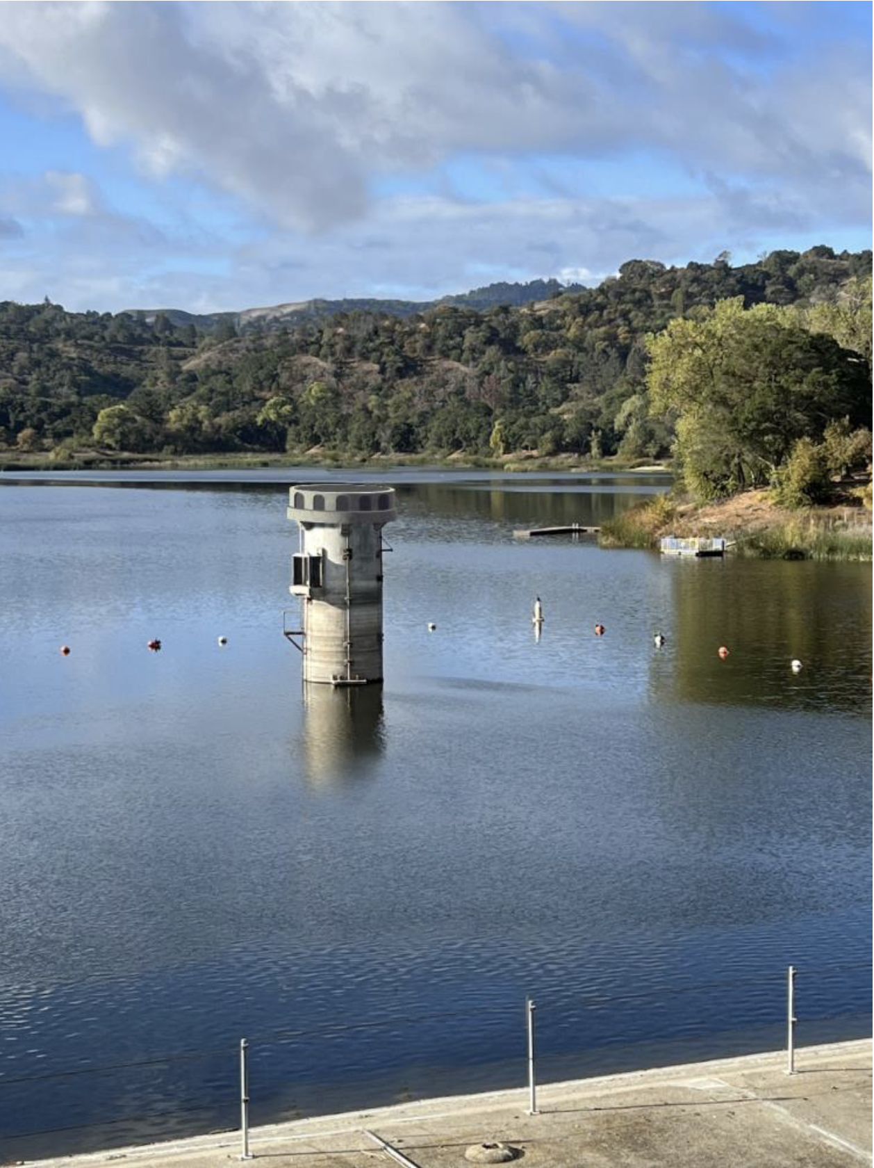
Actually, something is weird about this place. There’s this random tall cement tower in the middle of the water. First I thought it might be some observation post to get a panoramic view from the water… But from where would you even enter? Why does this high tower even exist?

Apparently the 170 feet tall tower was built in 1927 as a spillway (“Retrofit Project”). A spillway is the mechanism for water to passthrough a dam, avoiding potential damages from overfilling capacity (Britannica). Honestly, the answer somewhat confuses me because I associate spillways with a more clearly defined path, such as the large hole in Lake Berryessa being a spillway for the Monticello Dam. Therefore, I am either missing information or cannot see it directly.


Monticello Dam Spillway

Location: Napa County, California, United States of America

This tower is still abnormally forty feet taller than it should as the dam had to be built thirty-three feet lower than originally planned. Furthermore, the tower itself is at risk of collapsing to an earthquake. The owners and operators of the reservoir, the East Bay Municipal Utility District (EBMUD) aims to retrofit the tower to fulfill contemporary safety standards, while remaining an effective spillway, and to possibly “match [the] aesthetic of other District towers” (“Retrofit Project”). What’s the proposed new, innovative, and modern solution? Behold! The retrofit’s artistic render for the future!

Artistic render of the proposed “Lafayette Reservoir and Outlet Tower Seismic Retrofit Project” presented to the Lafayette city council by EBMUD engineers on January 9, 2023. Source: “Retrofit Project”

What? Did you expect more? Honestly, it’s pretty amusing to me that EBMUD had to hire someone to photoshop a render of block of cement onto the reservoir, and then explain in lay-terms why this utterly pedestrian design is objectively better for the community. 

But this solution creates a new problem for Lafayette. When Lafayette was trying to distinguish itself from other similar suburban towns, they sought a distinct, marketable icon that locals in the San Fransisco Bay Area can uniquely attribute to their town: the tower that now EBMUD is adamant about demolishing.

This means one of many possibilities: 

        1. Accede to the EBMUD’s plan and dismantle the tower.
          1. Find a new icon or produce a new marketable symbol for the town.
          2. Pressuring EBMUD to design a more “marketable” tower design than simply a block of cement.
          3. Move the tower somewhere else on land.
          4. Either of these options will require expending financial resources to find this new symbol, and then to market this symbol (i.e. changing the website).
        2. Try to preserve the tower.
          1. Do nothing, risk the safety of others. 
          2. Do an alternative retrofitting project that preserves the tower (and the abnormal height).
          3. Both of these method could cost millions of dollars in damages and construction costs (that do not guarantee safety from earthquakes) (“Retrofit Project”). 

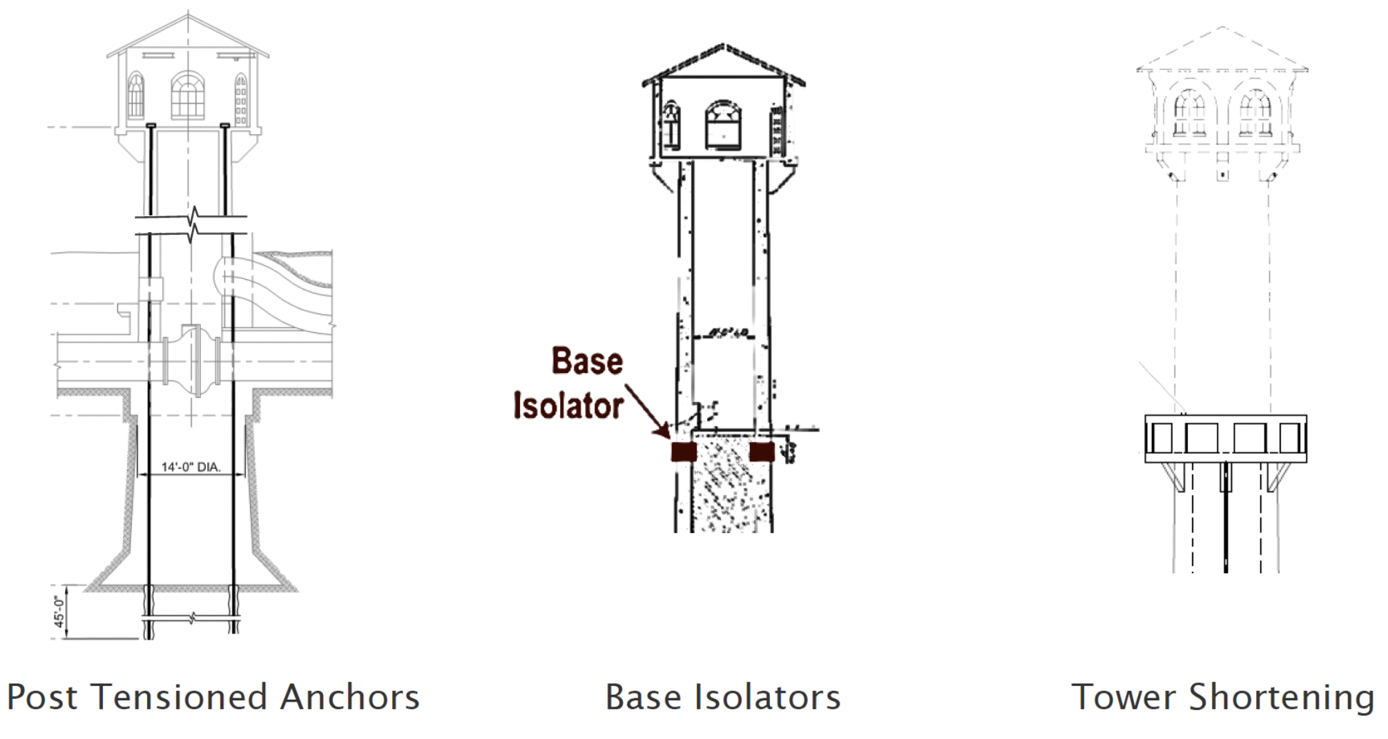
The proposed solutions. EBMUD’s preferred solution “tower shortening” costs $3.5 million. The others “post tensioned anchors” and “base isolators” cost at least $7 million and $4 million respectively (“Retrofit Project”; Cuff).


I think this situation is interesting because it forces a community to grapple with their identity. And having an outsider explain to residents that their marketable and distinguishable stylized hunk of concrete is a threat to the area is something that could be difficult to process. It certainly has brought debate to the city council. On one side, Councilman Mike Anderson “would love to see the landmark maintained” because “[w]e have adopted it as an iconic part of the city” (Cuff). On the other, Councilman Wei-Tai Kwok noted that while “we might have to search for a different icon for out city… it’s a design opportunity to create something new and iconic that’s beautiful and different” (Fancher).

Something to ponder, is that this admittedly somewhat goofy debate raises the question of what defines a communities identity? Is it the people? Is it the natural environment? Is it heritage they built?

Also, what would you do if you were in the position of Lafayette? Would you dismiss the tower as an artistically over stylized block of concrete or try to protect this symbol because of it being the community’s heritage? Personally, I would at least try to create new, contemporaneous symbols like a municipal flag, while deciding the merits of either side. But, what do you think? 

If you want to see my pictures of the area, click the picture below:

Footnotes

  1. Brochure available in English, Español, and 漢字 (Traditional Chinese Characters). 

Works Cited

“Lafayette Reservoir Recreation Area Brochure Map.” East Bay Municipal Utility District, https://web.archive.org/web/20230203004309/https://www.ebmud.com/download_file/force/16676/558?Lafayette_Reservoir_Brochure__Map.pdf. 

“Lafayette Reservoir and Outlet Tower Seismic Retrofit Project.” East Bay Municipal Utility District, 9 Jan. 2023. https://web.archive.org/web/20230319023318/https://www.ebmud.com/application/files/6516/7588/6630/Lafayette_City_Council_EBMUD_1-9-23_Lafayette_Tower_Final_Presentation_006.pdf. 

“Spillway.” Britannica School, Encyclopædia Britannica, 18 Aug. 2021. school-eb-com.ccclez.idm.oclc.org/levels/high/article/spillway/69131. Accessed 19 Mar. 2023.  

LaFayette 2020 Census Data, United States Census, https://web.archive.org/web/20230805214031/https://data.census.gov/table?q=Lafayette+city,+California&tid=DECENNIALPL2020.P1. 

Fancher, Lou. “Lafayette Reservoir Tower Seismic Retrofit Project Could Change Look of Iconic Structure.” Lamorinda Weekly, 18 Jan. 2023, https://web.archive.org/web/20230118062508/http://www.lamorindaweekly.com/archive/issue1624/pdf/Lafayette-Reservoir-Tower-Seismic-Retrofit-Project-could-change-look-of-iconic-structure.pdf. 

Cuff, Denis. “Lafayette’s Iconic Water Tower: Save it, or Save the Public Millions?” The East Bay Times, 24 Jan. 2018, https://web.archive.org/web/20210916040401/https://www.eastbaytimes.com/2018/01/24/lafayettes-iconic-water-tower-save-it-or-save-the-public-millions/.  

Clear Lake in an Unclear Day [Test Article #1]

California, Northern California, Travel

I was unsure of whether I would cover this kind of trip, but I want to experiment! If you want to see more writing of this type, please give me feedback! 

I felt like seeing one of the areas beyond the San Fransisco Bay Area to learn about places I might want to dedicate time to in the future. One such place is Lake County (map) (2020 pop. 68,163), directly north of Napa County (US CENSUS). I saw in maps that it had a large lake surrounded by various local communities and wanted to get a feel of the place.

Some context, Clear Lake is the largest natural existent freshwater lake in California. It has a surface area of 68 mi² (“Clear Lake”). Movement in the San Andreas Fault System, eruptions in the Clear Lake Volcanic Field, and erosion contributed to the lake’s creation. The lake is located between the Russian and Sacramento rivers, with the river it drains to occasionally changing, currently being the later (“History”).

Driving Torwards the Lake

 I realized how large this lake is as we started approaching it! The winding roads south of the lake are mostly short and residential, with different kinds of housing surrounded by trees and water. This housing varies from large, elegant houses to small, clustered, lakeside mobile homes. Regardless of housing type, most lakeside residents had some sort of dock, and nearby residents could still access the water through nearby docks, marinas, and local parks like Braito’s Buckingham Marina and Lakeside County Park

As you approach the west of Clear Lake, the surroundings increasingly become more commercial and industrial, and you enter the community of Lakeport (map), with a 2020 population of 5,026 (US CENSUS). It’s a fairly small town, but it has a small urban main-street with various businesses from restaurants, a clothing shop, and newspaper.

Thank You Essential Workers Mural

I stopped at and explored the small, quiet, yet comfortable Library Park that separates the main street from Clear Lake. It is a central area in the city that people can congregate and be together. It has… 1) Slides, swing sets, and the like for younger individuals. 2) A gazebo for people to congregate in the shade. 3) A concrete path adjacent to the lake. 4) And docks for boats. 

Library Park

My favorite part was seeing all of the ducks near the water. I am unsure if it is permitted, but I imagine locals feed them. Their presence in the water gives the lake life in an otherwise cloudy and quiet day. This is the kind of park that allows you to wander a bit and also traverse parts of the town without having to cross more streets. I did not spend that much time here though after strangers called out my camera from the gazebo, and instinctually recoiled away. 

Water, Clouds, & Ducks

After you leave Lakeport, there’s a brief section where the road and the lakeshore separate. With the cloudy skies, I felt the surrounding landscape with the trees evoke a mysterious, somewhat muted, yet interesting aura. The clouds covering the sky filter out the daylight, while the foliage-less trees make a stark contrast to the surrounding grass and water. And the apparently broken fence is a curious, and odd detail. I could not resist, and decided to stop the car and take a picture. Locals understandably do not appreciate a car blocking part of the lane, with one giving me the finger. Oops! I hope it was worth it…

Landscape of The Trees & Lakes

The northern coast of Clear Lake appeared to have less houses directly on the lake’s shore. Instead, there was more road directly adjacent to the lake, with more docks attached to the road. There did not appear to be much parking though for outsiders, thus it might be worth researching in advance whether those docks are publicly available to use. 

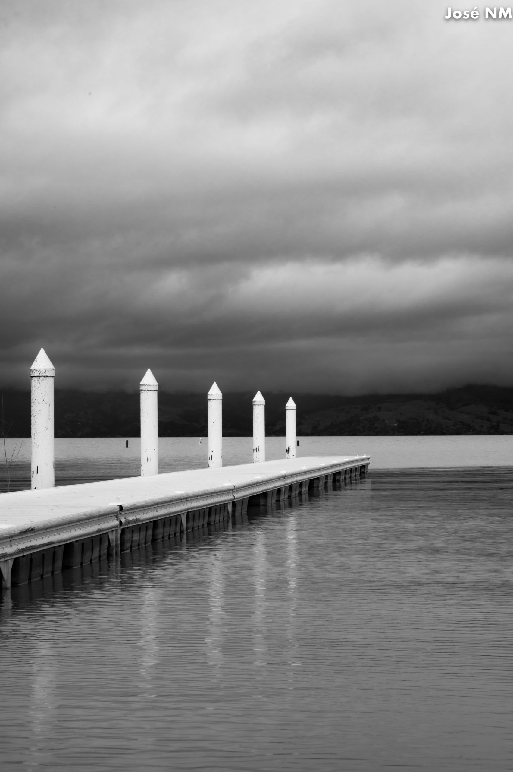
Surrounded Pier

Some of those docks were also wooden, with many seemingly abandoned and left to deteriorate over time. This even includes some houses that are apparently in such poor shape that its bridge disappeared! I wonder if these are still in use, albeit for specific functions, or if it is simply more troublesome to dismantle the remaining structure. 

Abandoned on Clear Lake

The eastern side of Clear Lake resembles the southern section with more houses closer to the shore. That said, the flora felt less dense in this area. Accessing the surrounding houses is more difficult by a thinner, somewhat more dangerous road. There is a greater sense of privacy as some communities are gated, or have signs indicating that only residents (and their guests) may enter. Said seclusion might be why I saw two deer roaming near the road. They did not seem phased by our presence. You might have slow-down to avoid colliding with unsuspecting fauna.

Deer Near The Road

I did not stop in the city of Clearlake, but it seemed commercial like Lakeport. Much of the signage welcomed anglers. I’m surprised that anglers specifically are a target demographic when the lake is close enough to the Bay Area to be a possible day trip for recreational boaters. It must have something to do with being called “Bass Capital of the West,” with two thirds of catches being largemouth bass, with the heaviest caught currently weighting 17.52 lb (“Clear Lake”). My biggest surprise from Lake County is that while Clear Lake is a pretty place to visit, it is very much a local’s destination. It is much more residential than what I expected, essentially being a bubble surrounded by the Northern Coast, Bay Area, and Central Valleys.

Lake County Homes

As for my reconnaissance, if you are mainly interested in seeing and enjoying the lake in a single place for the entire day, then I suggest Clear Lake State Park (brochure). There’s trails, swimming, marina, camping, cabins, and a visitor center. It essentially has most of the niceties for travel. It is worth noting that the visitor center when I visited was only open between 10:00 AM – 2:00 PM on Saturdays and Sundays. I also saw a sign promoting a “Story Walk” that occurred at 11:00 AM, in the second Saturday of each month. That said, the ranger warned us that this park tends to crowd on weekdays. You need to decide if the visitor center and “Story Walk” are preferable to crowds.

If you seek to learn the area’s local history, some possibilities include Anderson Marsh State Historic Park (brochure in English or Español), Historic Courthouse Museum, Gibson Museum and Cultural Center, and Lower Lake Schoolhouse Museum

One final potential point of interest is the Calpine Geothermal Visitor Center, open in Fridays and Saturdays and focused on geothermal energy. If you plan well in advance, you can schedule a tour to a concentrated area of power plants known as “The Geysers.”  

Clear Lake Coast

As I mentioned earlier, I wasn’t initially sure about writing about this trip because it does not particularly focus on a specific place, but rather the general vicinity. Could you tell me if you would prefer that I focus only on specific destinations, or would you enjoy every now and then more exploratory articles such as this one? I would really appreciate any feedback! Lastly, here is a URL that approximately shows the route I took exploring the area of Clear Lake: https://goo.gl/maps/qREuDzSBTLkMacH3A.

Check out my other pictures from this trip here: https://flic.kr/s/aHBqjAFxjC

Lake County & Clear Lake

Sources

“Clear Lake.” https://web.archive.org/web/20230330133548/https://www.lakecountyca.gov/1111/Clear-Lake.

“History of Clear Lake.” https://web.archive.org/web/20230328045012/https://www.lakecountyca.gov/1123/History-of-Clear-Lake.

Lakeport 2020 U.S. Census: https://web.archive.org/web/20230414003801/https://data.census.gov/profile/Lakeport_city,_California?g=160XX00US0639710 

Lake County U.S. Census: https://web.archive.org/web/20230414020541/https://data.census.gov/profile/Lake_County,_California?g=050XX00US06033